Table of Contents >> Show >> Hide
- What Is a Balloon-Eye View?
- Why Ham Radio Is Perfect for High-Altitude Ballooning
- APRS: The Workhorse of Balloon Tracking
- SSTV and Live Images from the Edge of Space
- What a Basic Ham Radio Balloon Payload Includes
- Rules, Safety, and Responsible Launching
- Weather Balloons, Radiosondes, and the Bigger Picture
- Planning a Balloon-Eye Ham Radio Mission
- Common Mistakes Beginners Should Avoid
- Why This Hobby Captures the Imagination
- Experience Notes: What It Feels Like to Chase the Sky
- Conclusion
There is something wonderfully unreasonable about tying a tiny radio, a camera, a GPS receiver, and a bundle of hopes to a balloon, then letting the whole thing float toward the edge of space. It sounds like a weekend project invented by a science teacher, a ham radio operator, and a mischievous weather balloon after one too many cups of coffee. Yet “Balloon-Eye View Via Ham Radio” is more than a charming phrase. It describes one of the most accessible ways ordinary people can explore near space, collect real data, transmit images, and track a flight from launch to landing using amateur radio.
High-altitude ballooning has become a favorite playground for schools, radio clubs, makers, engineering students, and backyard experimenters who want a taste of space without needing a rocket budget, a launchpad, or a nervous call from mission control. With a latex balloon, lightweight payload, parachute, GPS tracker, and radio transmitter, a team can send equipment tens of thousands of feet above Earth. At that altitude, the sky darkens, the horizon curves, and clouds look less like weather and more like a slowly stirred bowl of whipped cream.
The magic ingredient is ham radio. Amateur radio gives balloon teams a practical, flexible, and surprisingly educational way to send position data, telemetry, and sometimes live or near-live images back to Earth. Whether the payload uses APRS tracking, slow-scan television, a custom telemetry format, or a small beacon, radio turns a wandering balloon into a readable story. Without it, the flight becomes a game of “Where did our expensive foam box go?” With it, the chase team can follow the balloon’s path, predict its landing zone, recover the payload, and brag responsibly afterward.
What Is a Balloon-Eye View?
A balloon-eye view is the perspective captured from a high-altitude balloon as it rises through the atmosphere. It is not quite a satellite view, not quite an aircraft view, and definitely not the same as standing on a hill with binoculars while pretending to be dramatic. It sits in a special category often called “near space,” a region high enough to show Earth in a new way but still below the official boundary of outer space.
Many amateur high-altitude balloon flights aim for altitudes around 60,000 to over 100,000 feet. At these heights, a small camera can capture sweeping views of the planet, the thin blue atmosphere, and the blackness above. The payload may also measure temperature, pressure, altitude, battery voltage, speed, humidity, radiation, or other environmental data. For students, that data turns science from a diagram in a textbook into something that landed in a field, tree, or occasionally a very confused farmer’s pasture.
The view is beautiful, but the process is just as valuable. A successful balloon flight teaches radio communications, electronics, weather, aviation rules, teamwork, mapping, soldering, troubleshooting, and patience. Especially patience. No one has truly experienced high-altitude ballooning until they have refreshed a tracking map 87 times while standing next to a car full of antennas and snacks.
Why Ham Radio Is Perfect for High-Altitude Ballooning
Ham radio works well for balloon projects because it is designed for experimentation, public service, education, and technical learning. Licensed amateur radio operators can build, test, and operate communication systems across specific frequency bands while following national regulations. That makes ham radio a natural fit for high-altitude balloon payloads that need to send small packets of information over long distances.
At altitude, a low-power radio signal can travel surprisingly far because the balloon has a wide line of sight. A transmitter that might cover only a modest distance on the ground can be heard hundreds of miles away when it is floating above mountains, buildings, trees, and the usual collection of Earth-based obstacles. This is why balloon flights often attract listeners far beyond the launch site. A small APRS tracker, SSTV transmitter, or telemetry beacon can turn the surrounding amateur radio community into a distributed receiving network.
Ham radio also keeps the project hands-on. Instead of relying only on cellular networks, which often fail at altitude and may not be legal or reliable for airborne use, amateur radio encourages teams to understand antennas, modulation, power budgets, batteries, frequencies, and receiver setups. The lesson is simple: when your payload is dangling below a balloon in the stratosphere, “it worked on my desk” is not a full test plan.
APRS: The Workhorse of Balloon Tracking
One of the most common tools in amateur ballooning is APRS, the Automatic Packet Reporting System. APRS allows radio stations to transmit short packets of information such as GPS coordinates, altitude, speed, direction, and status messages. For a balloon payload, that means a tracker can periodically broadcast its location as it climbs, drifts, bursts, descends, and hopefully lands somewhere more convenient than a swamp.
In North America, APRS is commonly heard on 144.390 MHz, though exact frequencies and practices vary by country and project. A typical balloon tracker combines a GPS receiver, microcontroller, radio transmitter, antenna, and battery. The transmitter sends data packets that can be received by nearby stations, digipeaters, or internet gateway stations. Once received, the information can appear on online maps, allowing teams and curious observers to follow the flight path in near real time.
APRS is popular because it is practical. It does not require a heavy payload, a large battery, or a complicated ground station. A small, well-tested tracker can provide enough information to recover the balloon after landing. That recovery matters. The best picture from near space is not very useful if the memory card is resting forever in a cornfield, quietly becoming part of the agricultural ecosystem.
SSTV and Live Images from the Edge of Space
For many balloon teams, location tracking is only the beginning. The real thrill comes from sending images back by radio. Slow-scan television, or SSTV, is a method used by amateur radio operators to transmit still images over voice-grade radio channels. In a balloon project, an onboard camera can capture images and convert them into audio tones that are transmitted by radio. A receiving station on the ground decodes those tones back into pictures.
SSTV is not fast, and it will not deliver ultra-high-definition video of your balloon’s heroic ascent. It is more like receiving a postcard from the sky one image at a time. But that is part of the charm. Watching a noisy, slowly forming picture reveal clouds, horizon, and black sky is strangely addictive. It feels like the balloon is whispering, “You really should have brought a better antenna, but here is a photo anyway.”
Some projects use other digital image or telemetry methods, including custom protocols designed for weak-signal conditions. Others save high-resolution images locally on an onboard camera while radio provides tracking and basic status. The best approach depends on payload weight, power limits, licensing, available receivers, and mission goals. The important point is that radio gives the project a live connection to the flight, even when the balloon is far beyond visual range.
What a Basic Ham Radio Balloon Payload Includes
A high-altitude balloon payload does not need to be glamorous. In fact, the best payloads often look like something assembled from a science lab, a craft store, and a very organized junk drawer. The design goal is simple: light, reliable, insulated, trackable, and safe.
Balloon and Lift Gas
The balloon is usually made of latex and filled with helium or hydrogen. Helium is easier to handle but can be expensive or hard to source. Hydrogen offers excellent lift and is widely used in professional weather ballooning, but it requires serious safety precautions because it is flammable. The amount of gas determines the ascent rate, burst altitude, and flight profile. Too little lift and the balloon may wander lazily like it forgot its appointment with the stratosphere. Too much lift and the flight may end faster than expected.
Payload Box
The payload box is commonly made from foam or another lightweight insulating material. Temperatures at altitude can be extremely cold, so batteries and electronics need protection. The box should be strong enough to survive landing, light enough to comply with regulations and practical lift limits, and easy to open after recovery. Bonus points if it does not look like suspicious space trash.
Radio Tracker
The tracker is the heart of the recovery system. It may use APRS, a custom beacon, or another legal amateur radio telemetry method. It should transmit a clear call sign when required, send useful position data, and operate long enough to continue after landing. Many teams also include a secondary tracker, because redundancy is the difference between “successful mission” and “expensive hide-and-seek.”
Camera and Sensors
A small action camera or lightweight camera module can capture photos or video. Sensors may record pressure, temperature, acceleration, humidity, altitude, and battery voltage. These readings help students and experimenters understand what happened during the flight. They also provide excellent graphs, which are the scientific community’s preferred way of saying, “See, we told you it got cold.”
Parachute and Flight Line
After the balloon bursts, the payload falls back under a parachute. The parachute must be properly sized to slow descent without drifting forever. The flight train usually includes the balloon, parachute, payload, and connecting lines arranged so that the payload descends safely after burst. Good line management matters, because the sky is not the place to discover your knots were more decorative than functional.
Rules, Safety, and Responsible Launching
High-altitude ballooning is fun, but it is not a “launch first, ask questions later” hobby. In the United States, amateur balloon teams must consider aviation rules from the FAA and radio rules from the FCC. Larger or heavier unmanned free balloons may fall under specific FAA requirements, including rules related to payload weight, equipment, trailing antennas, operating conditions, and notifications. Smaller lightweight balloons may be subject to fewer requirements, but teams still need to understand the rules before launch.
For radio operation, amateur stations must follow FCC Part 97. That includes using permitted frequencies, identifying transmissions properly, avoiding commercial communications, and operating within license privileges. Balloon teams should coordinate frequencies, avoid interfering with repeaters or other users, and make sure transmissions are legal for the chosen band and mode.
Safety planning also includes checking weather, winds aloft, predicted flight path, landing zones, airspace, roads, terrain, and recovery access. Teams commonly use balloon prediction tools before launch to estimate where the payload will land. Predictions are not perfect, but they are far better than pointing at the sky and saying, “Probably east-ish.”
Weather Balloons, Radiosondes, and the Bigger Picture
Amateur ballooning has deep connections to professional weather observation. Weather services around the world launch balloons carrying radiosondes, small instrument packages that measure atmospheric conditions such as temperature, pressure, humidity, and wind. These observations feed weather forecasting models and help meteorologists understand what is happening above the surface.
That same basic idea inspires many ham radio balloon projects: lift an instrument package, collect data, transmit it, and learn from the atmosphere directly. The difference is scale and purpose. Professional radiosonde networks support forecasting and climate records. Amateur flights support education, experimentation, outreach, and sometimes the deeply human need to see whether a tiny camera can survive a trip to the stratosphere.
NASA’s scientific balloon program shows how powerful balloon platforms can be. Large scientific balloons can carry advanced instruments to the stratosphere for astronomy, Earth science, heliophysics, and technology testing. Amateur flights are much smaller, but they share the same basic spirit: balloons offer a lower-cost way to reach altitudes that are otherwise difficult to access.
Planning a Balloon-Eye Ham Radio Mission
A good balloon mission starts with a clear goal. Do you want to capture photos? Test a radio tracker? Teach students about atmospheric science? Practice APRS receiving? Compare temperature readings at different altitudes? The goal shapes every decision, from payload design to antenna choice.
Next comes the flight prediction. Teams enter launch location, payload weight, ascent rate, burst altitude, and weather data into a prediction tool. The output helps estimate the landing zone. If the predicted landing site is a lake, airport, military base, dense forest, or the backyard of someone who owns 14 goats and dislikes visitors, the team should adjust the launch plan.
Testing is the unglamorous hero of ballooning. Before launch day, teams should test the tracker outside, verify GPS lock, confirm radio reception, measure battery life in cold conditions, check camera storage, secure antennas, label the payload, and practice recovery procedures. A payload label with contact information can be very helpful if someone else finds it first. Ideally, that someone is friendly and not a raccoon.
On launch day, roles should be assigned. One person handles the balloon and gas. Another monitors the tracker. Another records data. Another watches weather and airspace. Another keeps everyone from stepping on the payload. After release, the chase team follows the flight using radio signals and mapping tools. The final recovery can involve hiking, polite conversations with landowners, and the triumphant retrieval of a foam box that has had a much more exciting morning than most people.
Common Mistakes Beginners Should Avoid
The first mistake is underestimating the importance of antennas. A poor antenna can make a good transmitter look broken. Payload antennas must survive cold, movement, spinning, and landing. Ground station antennas should be tested before the flight, not discovered in the trunk five minutes after launch.
The second mistake is relying on only one tracking method. If the main tracker fails, a backup beacon, secondary APRS unit, or independent GPS logger can save the mission. Redundancy adds weight, but losing the entire payload adds regret, which is heavier.
The third mistake is ignoring batteries. Cold temperatures reduce battery performance, and high-altitude flights can last longer than expected. Use batteries suitable for low temperatures, insulate them well, and test them under realistic conditions.
The fourth mistake is poor recovery planning. A predicted landing area is not a guarantee. Teams should bring maps, chargers, radios, antennas, water, tools, permission-requesting manners, and realistic shoes. Flip-flops are not recovery gear unless the balloon lands in a beach chair, which it will not.
Why This Hobby Captures the Imagination
Balloon-eye ham radio projects are powerful because they combine wonder with engineering. The mission begins with ordinary materials and ends with extraordinary perspective. A group of students can build a payload, launch it from a field, hear its signal from the sky, track its path across counties, and recover photos that look like they came from a spacecraft.
It is also a beautifully social hobby. Amateur radio operators may listen for the balloon, report reception, relay packets, help decode images, or join the chase. Teachers can turn the flight into lessons on physics, geography, meteorology, electronics, and communication. Makers can improve payload designs. Parents can watch kids suddenly care about wind speed. Everyone gets a role.
Most importantly, it makes science feel reachable. Space can seem distant, expensive, and reserved for professionals. A high-altitude balloon changes that. It says, “Here is a path upward. It involves math, tape, radio waves, and maybe a few zip ties, but you can do it.”
Experience Notes: What It Feels Like to Chase the Sky
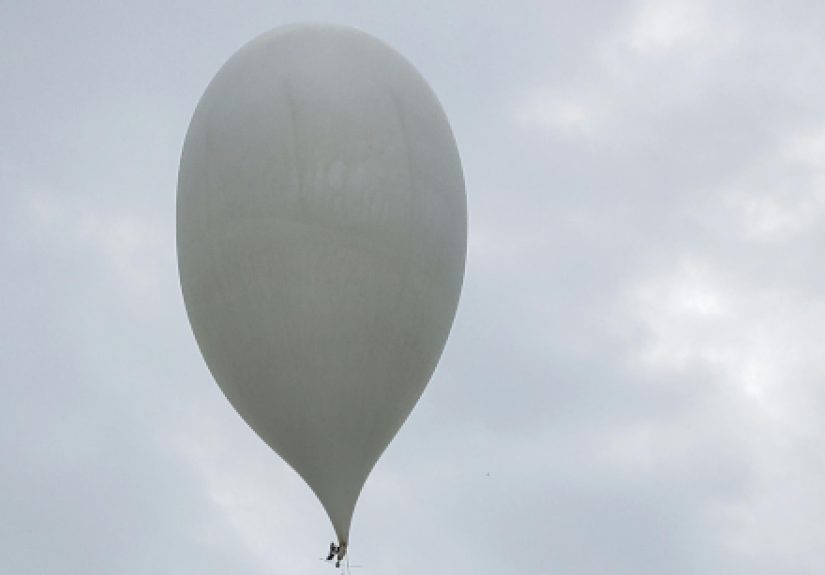
The first experience every balloon team remembers is the launch countdown. The balloon tugs upward with an eagerness that feels almost alive. The payload swings gently below it, the parachute hangs ready, and everyone suddenly becomes aware that their careful project is about to leave the safety of the ground. There is usually a strange silence just before release. Even the person who has been making jokes all morning pauses, because the moment feels bigger than the equipment.
Then the balloon rises, and for the first few seconds it looks fragile and slow. After a minute, it becomes a white dot. After a few more, it is gone. That is when the radio becomes the mission’s voice. A packet appears on the receiver. The altitude climbs. The map updates. The balloon is no longer visible, but it is still talking. That quiet beep or decoded line of telemetry creates a thrill that is hard to explain to anyone who has never chased a signal across the sky.
During ascent, the chase team often feels a mix of excitement and suspicion. Excitement because the balloon is working. Suspicion because something always could go wrong. A GPS fix might drop. A battery voltage might sag. The predicted path might shift. The balloon might climb faster or slower than planned. Every update becomes a tiny chapter in the story. At 30,000 feet, the payload is above most weather. At 60,000 feet, the camera may be seeing the curve of Earth. Near burst altitude, everyone watches the numbers with the intensity of sports fans during overtime.
The burst itself is often invisible to the team, but obvious in the data. The ascent stops. The altitude peaks. Then the descent begins. The payload may fall rapidly at first before the parachute fully stabilizes. This is the moment when the calm science project briefly becomes a falling object with a radio. Good telemetry is comforting here. It shows that the tracker is alive, the payload is descending, and recovery is still possible.
The drive to the landing zone can be the most chaotic part of the day. One person watches the map. Another listens for packets. Someone else argues with the navigation app. Rural roads appear, vanish, and reappear under different names. The balloon, naturally, chooses a landing site that is technically reachable but emotionally inconvenient. It may land near a fence, in tall grass, at the edge of a wooded area, or in a field that looks much easier on a map than it does in person.
Recovery is pure satisfaction. Finding the payload after hours of planning and chasing feels like discovering a message from another world. The box may be dusty, cold, dented, or decorated with grass. The camera may hold photos of clouds, horizon, and the black upper sky. The tracker may still be transmitting like a loyal little machine. At that moment, every spreadsheet, solder joint, weather check, and battery test feels worth it.
The best lesson from experience is that balloon-eye ham radio is not just about the view. The view is the prize, but the journey is the teacher. You learn that simple systems can do remarkable things when designed carefully. You learn that radio waves are invisible but dependable companions. You learn that weather is not a background detail; it is the road your balloon travels. You learn that teamwork matters because no single person can inflate, launch, track, drive, decode, document, and recover everything alone without eventually dropping something important.
You also learn humility. The atmosphere is large, the balloon is small, and your plan is only a polite suggestion to the wind. That is part of the appeal. Every flight is a negotiation with physics. Every recovery is a small adventure. Every image from altitude is a reminder that the world is bigger, stranger, and more beautiful than it looks from a parking lot.
Conclusion
“Balloon-Eye View Via Ham Radio” captures the joy of looking at Earth from a new angle using tools that are surprisingly accessible. High-altitude ballooning brings together amateur radio, APRS tracking, SSTV images, GPS telemetry, weather science, electronics, and hands-on exploration. It is affordable enough for schools and clubs, challenging enough for serious experimenters, and inspiring enough to make almost anyone stare upward a little longer.
The best balloon missions are not lucky accidents. They are built on planning, testing, legal operation, safety awareness, and respect for both aviation and radio rules. When done well, a ham radio balloon flight can send a small payload toward near space, share its location in real time, capture unforgettable images, and return with data that teaches more than any lecture alone.
In the end, the hobby works because it balances wonder with discipline. The balloon may float away like a daydream, but the radio keeps it connected to Earth. And when the payload finally comes home with photos from the edge of space, it proves that exploration does not always require a rocket. Sometimes, it starts with a balloon, a call sign, and a group of people willing to follow a signal wherever the wind takes it.